


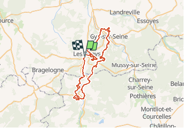

13,1 km | 15,9 km-effort

Gebruiker


Gratisgps-wandelapplicatie
 SityTrail
IGN / Geografische instituten
SityTrail World
De wereld gaat voor u open
Tocht Mountainbike van 57 km beschikbaar op Grand Est, Aube, Les Riceys. Deze tocht wordt voorgesteld door tracegps.
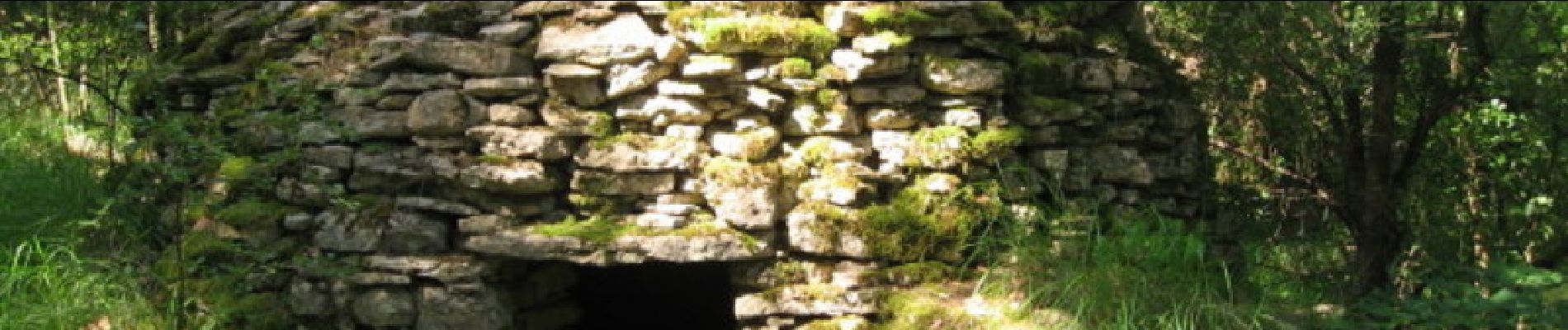
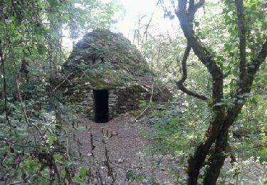
Une cadole c'est une petite construction primitive érigée par nos ancêtres vignerons, uniquement avec des pierres sèches trouvées sur place. Ces Loges (autre nom) ont été conçues pour que les viticulteurs s'y abritent, s'y réchauffent en hiver ou cherchent la fraîcheur en été. Les parcours du raid sont jalonnés de Cadoles d'où son appellation.


Stappen
Stappen
Stappen

Stappen
Stappen
Stappen
Stappen

Noords wandelen